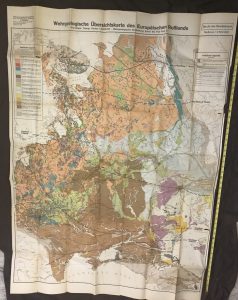
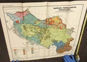
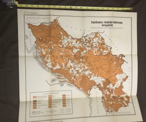
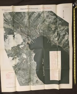
A few samples…
- This collection consists of German military maps from World War II. Place and date of completion is Berlin 1940-1942.
- There are 139 distinct maps and 46 accompanying booklets. Maps and booklets were arranged by region or country into 19 distinct packets.
- There are also many smaller fold-out maps or pages of maps inside some of the booklets.
- Collection items are marked “For Official Use Only.”
- Packet contents are described as “Military-Geographical Information” produced for the “Army General Staff” by the “Office of War Maps and Surveying.”
- Aside from maps of various sizes, the packets usually contain 1-4 booklets of varying lengths, some as long as 200+ pages.
- Usually the first booklet included, “Textheft”, gives a detailed textual description of the mapped region/country and often includes an “Overall Military Assessment” which points out the most important military implications of the information in both booklet and maps.
- Often the second booklet in a packet, “Bildheft”, consists of photos of various points of interest in the country.
- The maps and booklets cover all sorts of subjects. Aside from often incredibly detailed geographical information, there are maps and textual descriptions of telephone/telegraph lines, the ethnic/linguistic composition of a region (with a key focus being Germanic subpopulations), its systems for generating and transmitting electricity, its roads, railway lines, dams, water transport, airfields, administrative structures, key cultural institutions, and so forth.
- Nine or more of the “maps” are actually high-altitude photos on which specific targeting information has been superimposed. There are a lot of city plan maps, both photographed and conventionally mapped.
- As will be clear from the detailed list below, the overall focus is very much on the East.
- A few North African and Middle Eastern regions are also covered.
- In some cases, multiple distinct packets cover a single region. In other cases, our collection contains duplicate copies of the same packet.
- For easier site navigation, we have divided the packets into four groups, as given below.
| Packet Groups | Packet Names (19 distinct packets, 26 total counting duplicates) |
|---|---|
| Euro-Russia I | Moscow, Central Russia, Ukraine I, Ukraine II, & The Caucasus |
| Euro- Russia II | Overview of European Russia, The Volga Region, The Wologda-Archelansk Region, Baltics I, Baltics II, & Baltics III |
| SE-Europe | Yugoslavia (2 copies), Danube and the Balkans (2 copies), Greece, Northern Greece (3 copies), Romania |
| Other | Algeria, Egypt, Palestine-TransJordan |
- Almost all of the packets contain a table of contents inside the outer packet flap, so we were able to determine whether we have everything that was originally included in the packet.
- Where packets are incomplete or completeness can’t be determined, we have noted that.
- The condition of items should be clear from the images. Very few of the maps have tears or stains, but very many have some age yellowing of their good quality paper and almost all are deeply creased from having been folded up for some 80 years.
- The packet covers are in far worse shape than their contents. Do not judge the latter by the former.
- Photos of all distinct items of the collection are included in this website.
- Each region/country has its own web page, which in some cases includes multiple packets (e.g, Baltics I, II, & III). Use drop-down navigation in upper right corner.
- Region packet pages provide smooth and easy viewing. You can see the whole collection as quickly or as slowly as you choose.


